Previous: BHC SRN4 
 Next: SEDAM N500
[Hoverports page]
From the first commercial cross-channel hovercraft operated by Seaspeed, a division of the government run British Rail at the time, Dover has had a hoverport of some description. The SRN1 used the beaches at Dover for its historic landing, as have a few other craft over the years, but for no permanent base.
Two hoverports have been constructed at Dover, one remains today as spare land to the West, and the other to the East was used for the early SRN4 Mk I and II craft until the SRN4 Mk III outgrew it, requiring the construction of the Western hoverport.
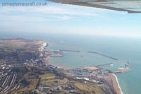
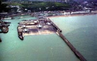
The Port of Dover is 2.76 x 1.4 km, roughly, and is surrounded on three sides by concrete breakwaters. It has two entrances for shipping, the Western entrance being the widest at 220m, and the Eastern entrance the smaller at 200m. The main ferry port at the "Eastern Docks" operates next to the Eastern breakwater, consisting now of nine berths for the ferry companies Sea France, P&O and Norfolk Line, which operate passenger and freight services to France and Belgium. The Eastern Docks stretch over 1.2km at their longest point.
To the other side of the harbour, past the Prince of Wales pier, is the Western Docks. These house the Dover Cruise Terminal and its three cruise liner berths on the Admiralty Pier, two marinas including Granville Dock and Wellington Dock, and the old pad of the Western docks Hoverport and terminal buildings.
Dover Eastern Docks
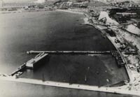
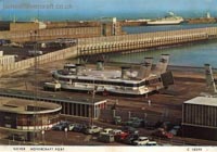
Pete Stevens sent these photos of Dover as it used to be, showing the Eastern Docks as they used to be (see the later photo of Dover as it is now). The Eastern Docks hoverport is clearly visible in the centre of the frame, with two craft on the pad. The second photograph of the Prince of Wales pier shows the pier in its original design, that being with an open metal frame. The building of the Western Docks hoverport saw the extension and filling in of the pier to its current form, with corrugated iron sides and concrete.
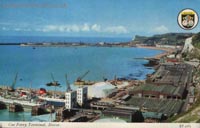
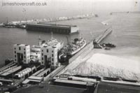
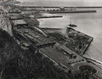
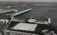
Photos and postcards sent by Nigel Thornton showing the old Port of Dover before today's developments. Note how sparse the port was, and the WWII submarine pens visible as what appear to be floating garages, in the bottom two photographs, which also show the Eastern hoverport under construction in the foreground.
The following photos are of activities at Dover's Eastern Docks and its Hoverport, operated by Seaspeed, using their two craft at the time, those being The Princess Anne and The Princess Margaret. Photos kindly sent by Pete Stevens
Dover Western Hoverport
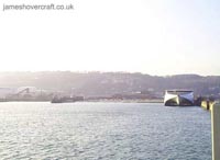
This hoverport was opened, after a 10 month delay to schedule following severe gales, on 5th July, 1978. It was christened into action by the arrival of the N500 Ingenieur Jean Bertin, preceding the services of the two Seaspeed SRN4s. A berth to accommodate the SeaCat was built adjacent to the pad and the Prince of Wales Pier, and this is still used today by SpeedFerries who operate a catamaran service to mainland Europe. Its location at Dover's Western Docks was originally decided in terms of its proximity to a planned rail route from Dover to Canterbury, providing quick change from train to hovercraft. However this idea was phased out due to financial difficulties, and the hoverport left stranded in its location.
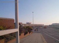
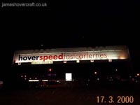
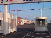
The following photos show the Hoverport at its most recent before the closure of Hoverspeed in 2005. It is now inaccessible by road and foot to the general public. The terminal and pad are now defunct, occasionally seeing smaller hovercraft arrivals during their transits up and down the channel.
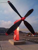
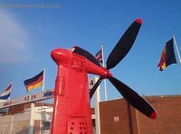
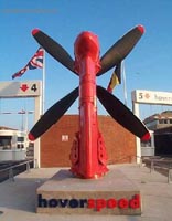
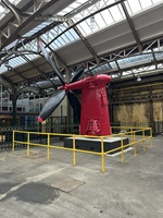
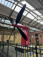
As of July 2009, the terminal buildings at the Dover Western Docks hoverport site have been demolished, awaiting development on the site. The pad still remains. The red propeller at the front of the site is (at the time of writing) apparently destined for transport to The Hovercraft Museum at HMS Daedalus, Gosport. Click for a photo gallery of the demolition.



-44.jpg)
-50.jpg)
-45.jpg)
-55.jpg)
-51.jpg)
-52.jpg)
-54.jpg)
-48.jpg)
-47.jpg)
